


Photo-transect survey
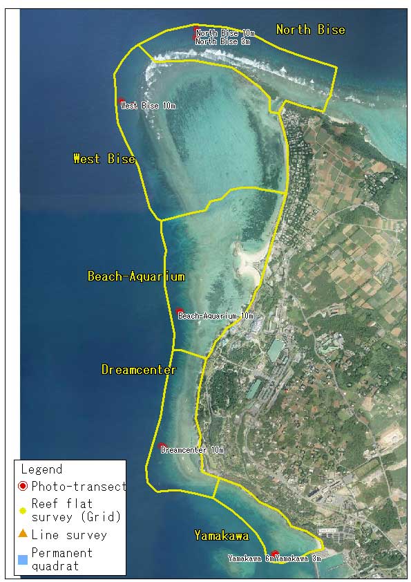
The photo-transect survey, which is sometimes referred to as the photo-quadrat survey in other monitoring manuals, aims to quantify the projected areal cover of coral and other sessile animals using digital photography and subsequent image analysis. Our survey method employs 1-m interval photography along each of 5 horizontal transect lines (40m long) at the depth of 3m and 10m. A total of 200 images are sufficient to minimize variability of coral distribution pattern within the transect lines.

Download "Photo-transect_results" (kmz format)
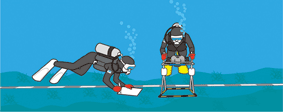
Photo-transect sites, coral cover data and some digital images can be viewed on Google Earth
Download Google Earth
Photo-transect sites, coral cover data and some digital images can be viewed also on Google Map
Photo-transect procedure
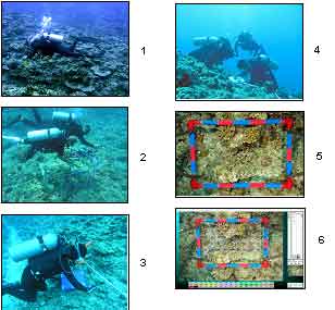
The photo-transect survey are conducted by 4 scuba divers to obtain photographs and juvenile coral data. At the start, a diver lays 5 x 40m tape measures on the bottom along the depth contour, either 3m or 10m (3m and 6m for Yamagawa Site), from the permanent marked point. The second and the third divers photograph the bottom (0.4m x 0.6m) at 1m interval along the tape measures. Then the fourth diver counts the number of juvenile coral colonies (< 3cm diamter) occurring in 0.3m x 10m along the first three tape measures. When photography and juvenile coral count are finished, the first diver and the fourth diver retrieve all the tape measures. Usually the whole survey procedure takes about 4-5 hours at each site.
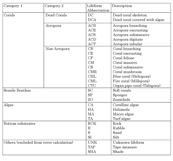
Digital photographs are analyzed using a PC with the software called Coral Point Count (CPC; Kohler and Gill, 2006; US National Coral Reef Institute, www.nova.edu/ocean/cpce/). CPC automatically overlay 70 grid points on each photograph. An observer identifies coral families or the lifeform categories (shown in the table below) occurring right under each grid point. After entering the data into a PC, CPC calculates percent cover value of each category and generates a data table in EXCEL format. Together with the digital photography described above, our protocol can provide sufficient statistical power for the comparison of coral cover data between arbitrary years.