


Permanent quadrat survey
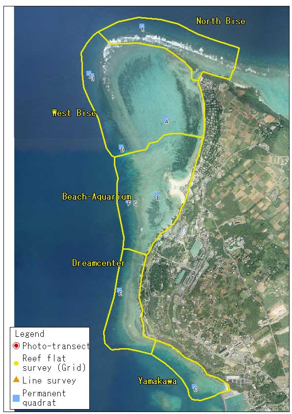
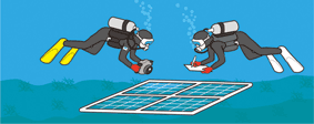
Permanent quadrat survey aims to investigate the temporal changes in corals and other sessile animals within a fixed square (quadrat) on the bottom by either illustrating or photographing. The size of our quadrat is 4 m2 (2m x 2m). Permanent quadrat survey provides information on the attribute of coral communities in a fine-scale and it complements the photo-transect survey. For example, we are able to know from quadrat data whether a coral community having the cover of 20% is comprised of several large colonies or many small colonies.

Download "quad" (kmz format, 351 b)
Permanent quadrat sites and photographs can be viewed on Google Earth
Download Google Earth
Permanent quadrat sites and photographs can be viewed also on Google Map
Permanent quadrat procedure
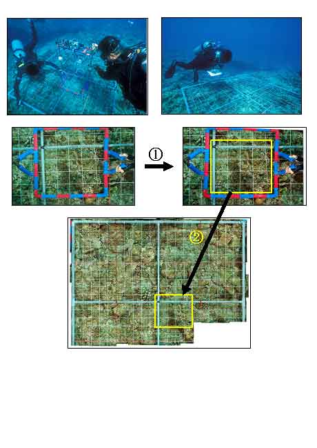
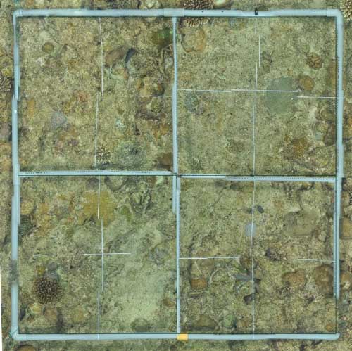
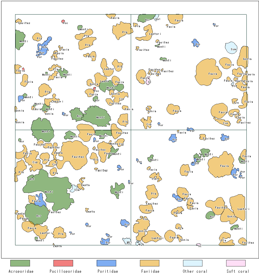
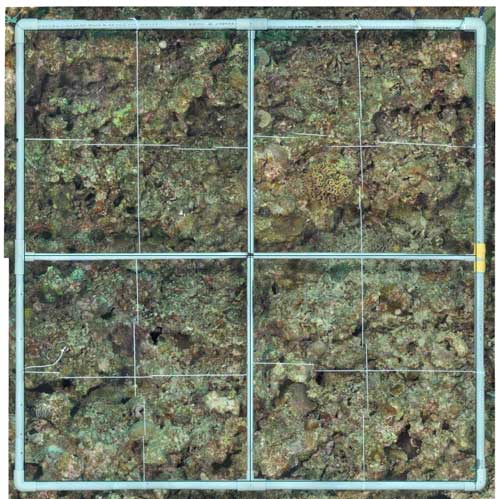
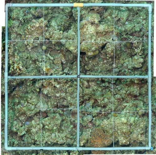
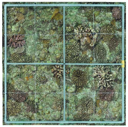
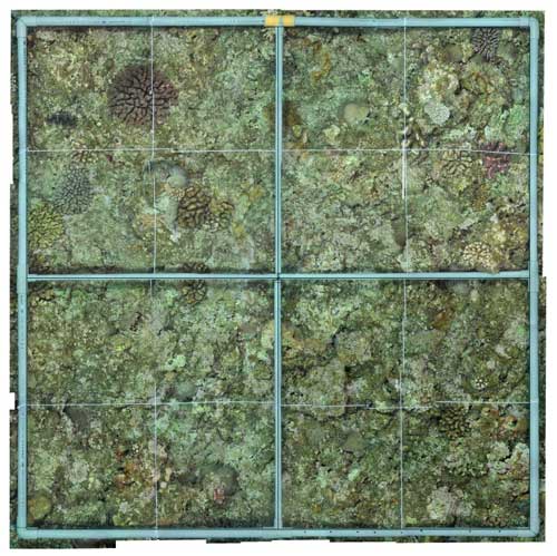
A quadrat is permanently marked with a steel reinforcing rod at each of four corners. Field work requires 3 or 4 scuba divers. A 2m x 2m PVC frame having 400 square grids (each grid is 10cm x 10cm) is placed on the quadrat in accordance with marking reinforcing rods. The quadrat is photographed with a digital camera by each of 50cm x 50cm divisions. The photos overlap about 60% between neighboring divisions. Then a diver records the position and species name of all coral colonies that occur within the quadrat. All photographs are corrected to remove distortion using a PC and image processing software and are merged to create a mosaic image of the quadrat. A detailed coral map of the quadrat is drawn based on the mosaic image and the position/species records made in the field. Projected area and percentage cover of each coral colony are determined by analyzing the coral map.
Permanent quadrat results
Quadrat C2
- Quadrat C2 is located at 2.5m depth of the reef flat near Yamakawa Port. This quadrat was re-installed in the nearby area of Quadrat C, which was installed in 1988 and disappeared in 2003.
- In 1988, branching Acropora (A. intermedia) dominated the coral community within Quadrat C with 79% coral cover. The shape of the Acropora colonies was slightly changed in the following year, but coral cover was still high at 68.9%. However, most Acropora colonies died from predation of the Crown-of-Thorns Starfish by the year of 1994. Total coral cover of Quadrat C decreased to 3%. Coral communities in the nearby area were also devastated. Soft corals such as Lobophytum sp. and macroalgae became the dominant group. There had been no sign of coral recovery in the next 9 years; the total coral cover was below 1% between 1998 and 2003.
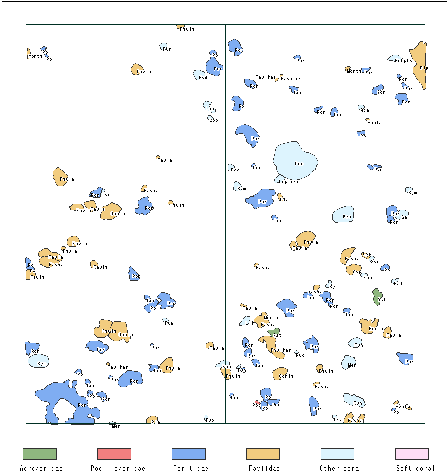
- In 2007, when Quadrat C2 was re-installed, most coral colonies (154 colonies in 16 genera) observed within the quadrat were 5-10 cm in diameter. The most frequently occurred coral genus was Porites (31 colonies) followed by Dipsastraea (10 colonies). Total coral cover of C2 was 10.9%.
- In 2011, a total of 178 coral colonies in 19 genera were observed within C2. The genus Dipsastraea became the dominant group. Total coral cover increased to 16.7%.
- In 2014, the number of coral colonies and total coral cover within C2 increased to 184 colonies and 25.3%, respectively. The average colony size of the dominant genus Dipsastraea was almost twice as previously measured. Meanwhile the number of colonies and coral cover of the genus Porites decreased to about a half in the past 3 years.
Quadrat E
- Quadrat E is located at 11m depth of the reef slope in front of Dream Center. In 1988, a total of 214 coral colonies (37 species) were observed within the quadrat. Dominant species were Porites horizontalata, P. lobata and Pachyseris rugosa with total coral cover of 23.7%.
- In 1989, the number of coral colonies and species increased to 299 and 43, respectively. The average colony size was smaller than those measured in the previous year, because there were many newly recruited juvenile corals. Total coral cover increased to 31.4%.
- In 1994, the number of coral colonies and species increased to 469 and 56, respectively. The dominant species was Porites lichen. Total coral cover of 49% was the highest among all years.
- After the mass-bleaching in 1998, the number of species (53 species) remained at the same level of the previous survey, but the number of colonies decreased to about a half (255 colonies). Total coral cover also decreased to 17%. Most coral colonies were in small size except for Porites cylindrica.
- In 2003, the number of coral colonies and species were decreased to 99 and 28. Total coral cover further decreased down to 5%. The majority of surviving colonies was Porites rus. In 2007, both the number of coral colonies (65 colonies) and the coral cover (1.9%) became the lowest among all survey years.
- The coral community within the quadrat showed recovery in 2011. The number of colonies increased to 160. Total coral cover also increased to 8.5% mainly due to the growth of Porites colonies. In 2014, a total of 144 colonies in 24 genera were observed. Total coral cover (8.9%) remained in the same level as the previous survey. Poritids and Faviids have been dominating the coral community.
Quadrat F
- Quadrat F is located at 7m depth of the reef slope in front of Okinawa Churaumi Aquarium. At the first survey in 2007, a total of 137 coral colonies in 15 genera were observed within the quadrat. About a half of the colonies was in the genus Porites (76 colonies). Most coral colonies except for Porites cylindrica were several centimeters in diameter. Total coral cover was 4.3%.
- In 2011, the number of coral colonies increased to 180 (21 genera). Total coral cover also increased to 9.5%. An increase in the number of Dipsastraea colonies was remarkable (19 colonies in 2007 to 43 colonies in 2011), although Porites still outnumbered other corals.
- In 2014, the number of colonies within the quadrat was 224 (18 genera). Total coral cover increased to 16.1%. This was due to the growth of existing Poritid and Faviid colonies.
Quadrat G
- Quadrat G is located at 3m depth of the reef slope near Quadrat F. At the first survey in 2007, a total of 93 coral colonies in 14 genera were observed within the quadrat. Total coral cover was 2.2%. The majority of coral colonies was Faviids (47 colonies, 1.0%) and Poritids (32 colonies, 1.1%).
- In 2011, the number of coral colonies and total coral cover increased to 144 (18 genera) and 5.9%, respectively. Porites (49 colonies) and Dipsastraea (39 colonies) were the dominant genus.
- In 2014, the number of coral colonies was the same as the previous surveyed (144 colonies in 17 genera), but total coral cover increased to 8.9%. A remarkable increase in the average colony sizes of Dipsastraea and Cyphastrea contributed to the increase in coral cover.
Quadrat I
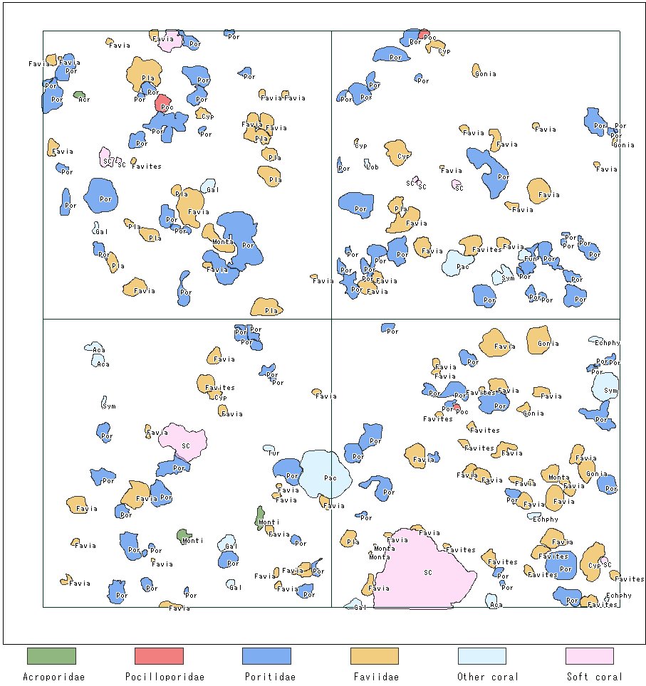
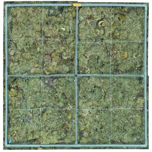
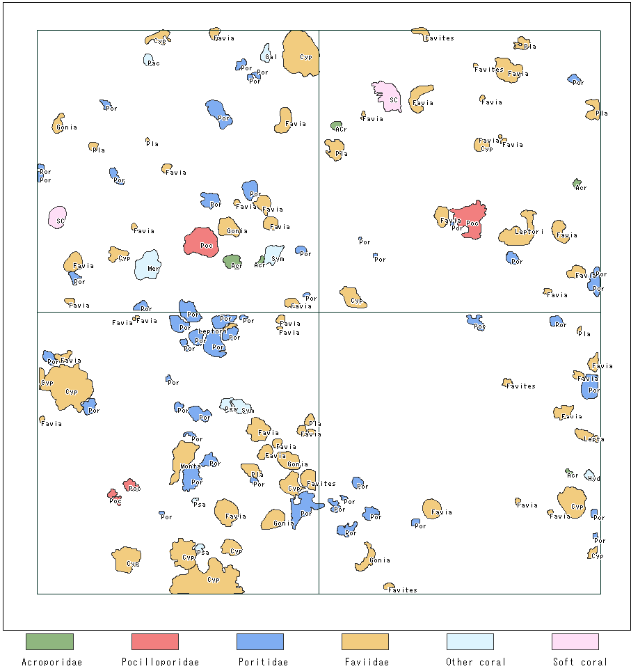
- Quadrat I is located at 9m depth of the reef slope west of Bise District. At the first survey in 2007, a total of 281 coral colonies in 24 genera were observed within the quadrat. Total coral cover was 14.5%. Faviid corals overwhelmed other corals in both colony number and coral cover (180 colonies, 5.3%). The subdominant groups were Poritids (27 colonies, 1.0%) and Acroporids (24 colonies, 0.8%). The majority of coral colonies were less than 5 cm in diameter. Large colonies of soft coral (Sinularia sp.) were observed within and nearby the quadrat.
- In 2011, the number of coral colonies and total coral cover increased to 339 and 24.3%, respectively. The coral cover of the genus Pocillopora remarkably increased from 0.45% (15 colonies) to 7.1% (23 colonies) since the previous survey. This indicated that some existing colonies had grown to larger sizes in 4 years. In contrast, Dipsastraea increased the colony number rather than coral cover (46 colonies, 1.3% in 2007 to 133 colonies, 4.6% in 2011).
- In 2014, a total of 256 coral colonies in 27 genera were observed within the quadrat. Total coral cover further increased to 31.7%. The highest coral cover was recorded for Pocillopora (17.3%), though the number of coral colonies was highest for Dipsastraea (100 colonies). The average colony sizes were quite different in these two groups (256.6 cm2 for Pocillopora and 15.5 cm2 for Dipsastraea).
Quadrat J
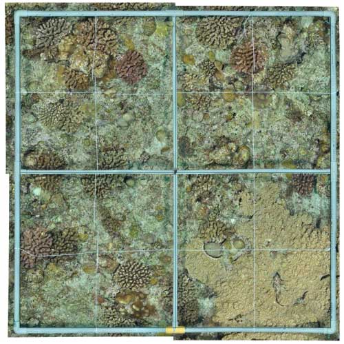
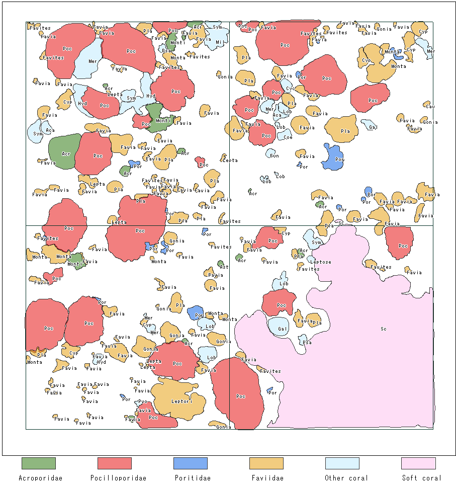
- Quadrat J is located at 7m depth on the reef slope west of Bise district. At the first survey in 2007, a total of 279 coral colonies in 26 genera were observed within the quadrat. Total coral cover was 13.8%. The coral community within the quadrat was dominated by Faviid corals in both colony number and coral cover (170 colonies, 6.6%). However, the average size of colonies was larger in Pocilloporids (31 colonies, 3.6%) and Poritids (31 colonies, 1.3%).
- In 2011, total coral cover increased to 35.8%, while the number of colonies within the quadrat was slightly decreased (270 colonies in 25 genera). This was due to the growth of existing Pocillopora colonies (36 colonies, 18.1%).
- In 2014, a total of 216 colonies in 23 genera were observed. Total coral cover was 47.5%, which was the highest among all quadrats. Coral recovery within the quadrat had been continuously supported by the growth of Pocillopora colonies.

Quadrat K
- Quadrat K is located at 9m depth on the reef slope northwest of Cape Bise. At the first survey in 2007, a total of 90 coral colonies in 18 genera were observed within the quadrat. Total coral cover was 3.2%. Pocilloporid colonies accounted for about a half of total coral cover (7 colonies, 1.8%). The number of colonies were larger in Faviid (32 colonies), Poritid (9 colonies) and Acroporid (12 colonies), but their average sizes were very small.
- In 2011, total coral cover increased to 15.4% despite a small increase in colony number (118 colonies in 16 genera). Pocilloporids dominated the coral community in both colony number (23 colonies) and coral cover (7.2%), followed by Acroporids (15 colonies, 1.5%).
- In 2014, a total of 153 colonies in 18 genera were observed. Total coral cover slightly decreased to 15.0%, while the total colony number increased since the last survey. In particular, Galaxea became one of major corals in both colony number and coral cover (38 colonies, 2.5%).