


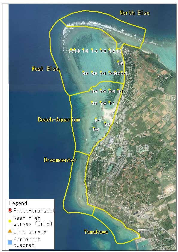
Reef flat survey
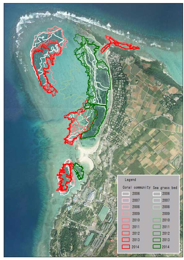
Generally, coral distribution pattern of the reef slope is characterized by zonation in accordance with depth, as types of corals are affected by wave action and light availability. On the other hand, on the reef flat where the depth remains relatively constant, corals are affected by other environmental factors such as the bottom substrate and they tend to form patchy distribution.
Therefore the survey method should address horizontal tracts of coral habitats. The same can be said of the distribution pattern of seagrasses and algae.
We monitor the changes in the size of coral and seagrass habitats on the reef flat off Bise district by drawing a detailed map every year.

Download "moat" (kmz format, 350 b)

Download "grid" (kmz format, 350 b)
The results of Reef flat suvey and Grid survey can be viewed on Google Earth
Download Google Earth
The results of Reef flat suvey and Grid survey can be viewed also on Google Map
Reef flat survey procedure
Habitat mapping
Habitat mapping requires a few snorkel divers and portable GPS receivers in waterproof bags. Snorkel divers record the GPS track while they swim along the boundary of coral and seagrass patches. The boundary of each habitat is determined at the coverage of 50%. GPS tracks are downloaded to a PC to draw a habitat map on aerial photos using GIS software.
Grid point observation
Grid point observation involves collecting qualitative information on corals and other benthic communities at representative point of major habitats. Snorkel divers photograph the underwater scape and make a record of species that occur within 5m x 5m square around the point.
Map of coral communities and seagrass beds